Web Site Design
This page has been included to give information
about the fellscape site which I hope will serve to answer the questions posed
in the emails that I have have received over the years.
The site was started over 20 years ago to combine the author's interest
in learning to write a web site, walking in the countryside with a
pub as an objective, and photography. The site itself has been put
together using Adobe's Suite of programs: Dreamweaver (web site
design) and Illustrator (the drawing program
in which the maps were drawn). My computer is a Mac so the site has
been tested with the Mac Browser Safari, and also with Firefox and
Opera browsers. However, Chrome has been found to be the best browser with Safari the least favoured.
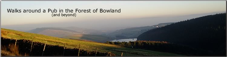
Walks in the Forest of Bowland
I started the walks in the winter of 2002 from my then base at Stonyhurst
College and worked my way clockwise around the Forest of Bowland; 17
Walks in all. These walks
range from 6 to 11 miles. Each walk is designed to print out on a sheet
of A4 paper.
It was my intention from the outset to vary each walk so that the walk
starts low down, takes in part of a fell, and then returns to the level.
Clearly the nature of the path will vary. Once on the open
fell the walker might expect to meet a stony or rutted path, potholes,
wet/ muddy/ marshy/ boggy- ground , and fairly steep inclines; this
is all part and parcel of fell walking in the Forest of Bowland. Bearing in mind that the Forest of Bowland is one of the wettest areas in England, it goes without saying that the walker should be adequately clothed and
shod, and a compass carried to find the occasional bearing.
5 circular walks are described which allows the River Hodder to be followed and explored.
Shorter Walks
For those walkers who might find the above walks too long or challenging a start has been made on a series of shorter walks. This project started with three walks from Hurst Green. 11 walks have now been completed and the project is ongoing.
Other Walks - Lakes and Dales
I published some other walks from The Lake District and Yorkshire Dales on another website "fellscape-walks.co.uk" but have now transferred these walks to this website. Hits on the other website are now transferred to the index page on this site.
Maps
The small map on each web page is only intended as a guide; the walk stages are shown and points which help the walker along the way i.e. houses/farms/woods. It would be expected that before any of these walks is started the walker will have familiarized his self/herself with the route on the relevant O.S. map and that the this map is at hand along the way. The Ordnance Survey has provided the Digital Hub asset which allows an O.S. map to be used on a web site. Such an O.S. map is now included on each web page as a pop-up; the map should be printed off and used on the walk.
A blank O.S. map can be printed off by clicking here for portrait or here for landscape.
Use the scale control on the map (top left) and then drag the map to where it is required.
Public Rights of Way
All the walks follow Public Rights of Way or concessionary footpaths. At times it may be necessary to leave the footpath for a short distance to negotiate some obstacle e.g. marshy ground, fallen trees. I leave it to the good sense of the walker to solve such a problem. Where a problem might exist, I have indicated this in the walk directions but for legal reasons do not offer any advice.
Dogs
Whilst many walkers take their dog with them, these walks as described are for humans only. It goes without saying that a walker with a dog on paths in the countryside can meet with a number of problems. Cattle especially with calves and sheep with lambs may react to the presence of a dog which should always be on a lead. Stiles are usually constructed for humans not for dogs. In the shooting season the path may be closed for walkers with dogs, this is especially the case when the shoot in on Duchy of Lancaster land.
Height Profiles
Some maps have a height profile shown above them. These give the walker some idea of the ups and downs of the walk, and how much energy is expended covering the distance. The distance given for each walk is measured along the flat surface of the respective map i.e. as the crow flies. However, the walker will cover more than this distance walking up and down the fells. It may be possible to measure the true distance covered by the walker using gps. Where this information has been obtained this distance is shown in brackets.
The Countryside Code
Before starting on any of these walks, it is assumed that the walker is aware of the Countryside Code. This is especially important in the Forest of Bowland which is an AONB, contains SSSIs, and is part owned by the Duchy of Lancaster. Read the Countryside Code on The Natural England web site.
SSSIs include: Barn Gill Meadow near Stocks Reservoir; Bell Sykes Meadows, Myttons Meadows, and Standridge Farm Pastures all at Slaidburn; the Bowland Fells; Clitheroe Knoll Reefs at Downham; Coplow Quarry Clitheroe; Hodder River Section at Stonyhurst; and White Moss near Tosside (further information on the location of these sites can be found here here.)
Pubs
If the walker is intending to visit a pub, it is best to check on opening times with the pub's website. Some pubs may be closed on certain weekdays. The inclusion of a pub in these walks is purely for information; other web sites deal with their relative merits; see for example: ribblevalleypubs.blogspot
Although this site is entitled 'Walks around a Pub' unfortunately since starting this project at least 10 pubs featured on the walks have closed and hence no longer open.
Links
Links to all pubs in the Forest of Bowland have been given where these are known.
The photos for each pub were taken without there being any traffic or parked cars in the front. This sometimes required an early start on a sunny Sunday morning.
Some walks have had a photo album/slideshow added. This project is ongoing much depends on the weather on the day of the walk.
All photographs on the site are copyright of the author.
Photos - Slide Show
Photos for each walk can be seen on a video popup. It is best to view these slides in full screen. The Photos are intended to give a flavour of the walk.
Satellite Images
In 2006 a satellite image for each walk was added as a pop-up. These have recently been upgraded to maximize the magnification.
Statistics
Charts summarizing the information regarding the Unique Visits paid to this web site for the year 2021
There are approximately 39000/annum.
The referring URL's are mainly the Google and Yahoo search engines.
Non-Commercial Website
I refrained from accepting invitations
to have banners put on the web pages. My objective is to keep these pages simple
and to the point
i.e. to give information solely on the walk in hand and the
relevant pubs. However, if there is any business in the Forest of
Bowland connected with walking or pubs which would help sponsor the site
and in turn have a link from each web page, then I would be willing listen
to any offer.
Comments, information, and communication
with the author can be made to:
![]()
The site was last updated