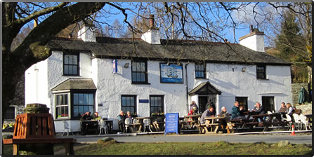
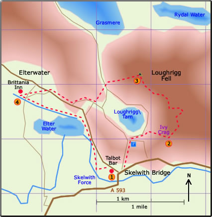
This is a fairly easy walk to navigate. The walk starts close to the hotel in Skelwith Bridge and follows a gentle path around the base of Ivy Crag and then up to the obelisk which marks the summit of Loughrigg Fell. Here there is a 360 panoramic view of the surrounding countryside with Grasmere, Rydal Water, Windermere, Elter Water, and Loughrigg Tarn clearly seen. The descent is gentle at first but then much steeper. The road goes round to The Britannia Inn at Elterwater. The final part of the walk is a stroll alongside Elter Water following the Cumbria Way. Skelwith Force is seen at the end just before the Talbot Bar.
A circular walk from Skelwith Bridge to Elterwater over Loughrigg Fell
Distance 5.04 miles; time about
3 hours
< previous
walk walk
4 next
walk >
walk
4 next
walk >
Warning: after the summit there is a steep descent down the side of Loughrigg Fell.
 The walk starts at the right-hand side of the white cottage at the road junction. Ivy Crag is seen on the right on the steady climb uphill. At the top of the road turn right over the stone bridge and then sharp left up to the cottage. Turn right and head for Ivy Crag. The path starts proper after the wooden gate with the lovely stone wall on the right. A steady climb follows the base of Ivy Crag. At the end of the stone wall the vista opens up and the path continues to a mini summit at a mini tarn. (55 min)
 The path now turn sharp left up the fellside. For the most part the path is well defined to the summit of Loughrigg Fell. Even though the path winds in places generally head north-west and keep going uphill. The summit is defined by an obelisk with a 360 panoramic views. Grasmere and Rydal Water to the north, Windermere to the south, and Elter Water to the west. (35 min)
160628